Friday, October 31, 2014

Death Valley October 27

Monday, October 27

We came into Death Valley National Park Sunday evening on California 190 east from U.S. highway 395.  We got into the park just after dark and found a campsite at the Panamint Springs RV park.   It’s named for the Panamint Mountain Range that runs north and south on the west side of Death Valley.  We were warned to fill up the gas tank before we got there and you can see why from the first picture.  We did not buy gas there.  There are two other places to buy gas in Death Valley National Park and they were both consistent with what we had been  paying in California.  I can’t explain why this one was marked so high.  I did not see anybody pump gas there.

We moved on into Death Valley Monday and camped for the next three nights at Furnace Creek Campground.  That’s where the visitor center is and the Furnace Creek Inn and Resort. It’s the central part of the park and has most of the facilities.  Names of places and features in Death Valley are along the lines of Furnace, Stovepipe, Devil and Hell.  Since it holds the worldwide record for the hottest day on earth it does seem to be fitting.  It was 134 degrees F in 1913.  Thank goodness we didn’t vacation there then.

As for touring Death Valley features on Monday, we hiked into Mosaic Canyon near Stovepipe Wells.  It is colorful and the canyon walls are slick and shiny marble.  Some of it was hard to climb over because it was so slick.  This is caused by the rushing water coming down the canyon to smooth and shine the rocks.  It worked well on the marble.  I was speaking to another visitor who was an equipment operator at some of the national parks including Death Valley and he said it only takes a small amount of rain in the upper elevations to become a torrent down the canyons and wash tons of rock and debris out onto  the valley floor.  Some of the debris are strange attractions in Death Valley.  As for rain in Death Valley, it  only averages 2 inches per year.

After our hike into the canyon, we went into the store at Stovepipe Wells before re-hitching the trailer.  We had to drop it off before we drove up to the canyon trailhead.  While we were at the store, I noticed a young couple having their Ramen Noodles on the patio.  Their saddle-bagged bicycles were nearby. I asked them how far they had traveled.  They had been on the road for 4 months coming from Alaska on their way to Brazil.  I didn’t doubt them.  They looked road worn.  I thought about them all that night wondering how you do that and what do you pack in  your saddlebags.  I’d say they were in their mid-20s.


Monday evening, after setting up the trailer at Furnace Creek,  we went over to the ruins of the Harmony Borax Works.  As you might know, Death Valley is famous for its Borax mining.  Many had also searched or gold in Death Valley but Borax  was the money  maker – while it lasted.  Harmony Borax operated there only about 5 years in  the 1880s.  Chinese immigrants did most of the heavy lifting shoveling the borax salts off the valley floor into wagons to be taken to the refining plant on site.  The refined Borax was then hauled to market or transportation points on 20 Mule Team Wagons.  Remember “20 Mule Team Borax”?  Housewives swore by it.  There were other borax mining operations after Harmony.


Gas Price at Panamint Springs


Is this really Death Valley?  Yes, it is!


Mosaic Canyon


Death Valley Sand Dunes


Death Valley Sand Dunes


Borax Salt


Borax Salt


20 Mule Team Wagon, 2 for Borax, 1 for water for mules


A Roadrunner in the parking lot.

Thursday, October 30, 2014

Yosemite National Park

Hello again my faithful readers, ha.  You probably thought it was all over but no chance.  As I explained in the Reno to Mono post we just had no connections.  But  tonight we do.  This is Thursday, October 30 so I'm really playing catch up.  I should be able to post tomorrow about our stay in Death Valley. I'll just say one thing now then more tomorrow about  it. It was incredible and possibly the high point of the trip.  We loved it.

Saturday and Sunday,October 25, 26.

Today we went into Yosemite National Park.  It was pretty crowded but not what it’s like in the summer.  Still, it was a nice Saturday with lots of sun and warm weather and it brought a lot of people in. 

We camped at the Forest Service Campground west of Lee Vining, Ca. then drove in the east entrance over Tioga Pass.  Tioga Pass is at 9900 feet with an 8% grade to the National Park  gate.  We did not take the trailer.  After passing through the gate, we stopped at a couple of pullouts then drove on into the main feature area of the park which is Yosemite Valley.  There we parked in a lot and rode the shuttle bus around to all the stops.   It’s also a decent tour itself.

The valley is mainly incredible scenery of white granite cliffs.  Everyone has heard of and seen El Capitan and Half Dome.  They do stand out but they aren’t the only ones to see.  There is also the Cathedral Spires.  As in all the parks there are hiking trails to take to falls and other features.  We only took the short walk up to Yosemite Falls but there was no water in it.  That is typical of this time of year.

It started to rain about 5:00 so we headed back to camp.  The rain turned to snow about 6000 feet.  Just before dark there were several cars stopped on the road for no apparent reason.  Cars stopped in national parks for no “apparent” reason usually means a pretty good reason.  There was a big black  bear sauntering along  in the woods.  So, lucky us.  We  saw our first black bear but got no picture.

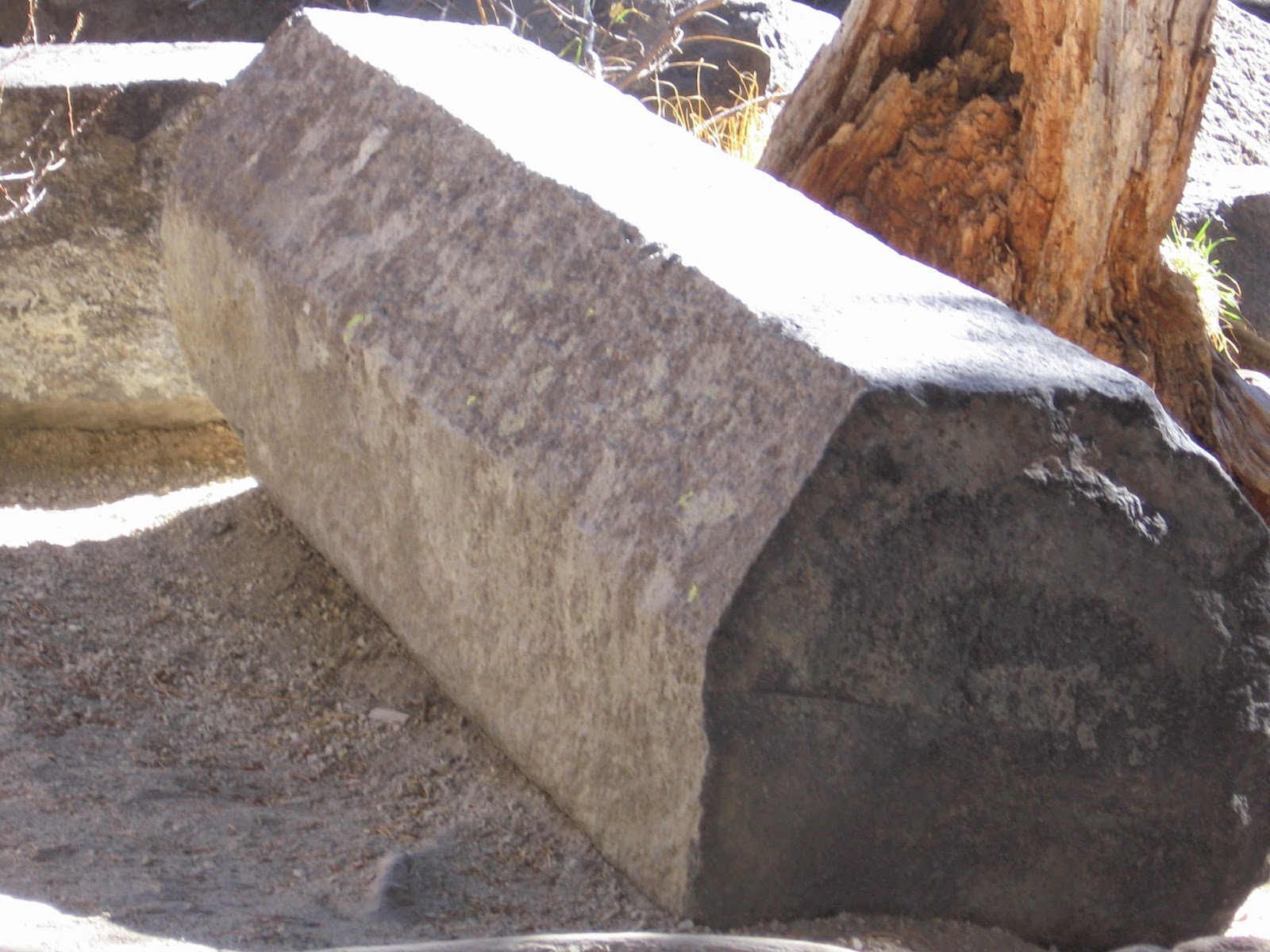
Sunday, we left our camp heading to Death Valley.  I was talking to another camper who was there fishing with his sons and he said we might want to make stop at the Devil’s Post Pile.  We had no idea what that was but we saw the sign directing us to it so we went.  It was 15 miles off the highway and a steep climb through the city of Mammoth Lakes, a ski resort town.  Then we had to  drop the trailer off because of length  restrictions and finally got to it.  It was a really amazing thing to see.  It is a geologic feature caused by volcanoes or something  and it created these  post-like  rocks with an almost constant hexagon cross section.  Some are fallen down but a lot are together like a fence.  You have to see it to believe it.  It was a nice little stop.  Note that the Devil's post pile is not at Yosemite.


El Capitan, probably the face of Yosemite National Park


El Capitan again


Half Dome - People climb up these vertical faces


Half Dome again


Cathedral Spires


Devil's Post Pile


Devil's Post Pile - These are Rocks!


Cross Section of Rocks

Reno to Mono Lake

Hello again, everyone.  Thanks for checking in from time to time.  As you probably guessed, we've had no connection at all for a week.  Some of our time has been in Death Valley and we just couldn't do it at all there.  So, we're connected  tonight and I'll try to start getting caught up starting at Reno.

Friday,October 24.

We stayed Thursday night at the Shamrock RV Park in Reno, NV.  Linda did laundry and I blogged and cleaned the trailer some and walked the dog.  You can start to see our division of responsibilities.  Then later we drove down Virginia Street into downtown Reno.

We walked along Virginia Street and went in a few casinos to see what the restaurants were serving then picked one.  We went to the Cal-Neva.  I had salmon and rice and Linda had steak and lobster.  Then we played a few games of Keno and lost a few dollars. 

I like Reno.  We were here once before, about 40 years ago.  It has grown, sprawled really.  It used to be just a little gambling mecca but I guess they have more industries here now along with improved highways.  But you still get the intimate feel of the little city walking downtown.  You can go from one casino to the next in a short distance.  They still have the old famous Reno sign across the street and a new one too.  See the pictures.

We left this morning heading south on U.S. 395 to Yosemite National Park.  There’s a 6-lane highway linking Reno and Carson City.  I remember Carson City as being a little town with a few casinos and a historical district downtown that showcased their western and gold prospecting past.  It has its own sprawl now with the typical fast food businesses, etc.  That pained me just a little.  I liked it better as I remembered it.

We’re camped tonight in a Forest Service Campground just west of Lee Vining, Ca. on Highway 120, about 10 miles from Yosemite East Entrance.  We’ll go into the park tomorrow.

As we climbed the last mountain pass to Lee Vining, we came upon a scene of a great big lake with islands and white material around the water’s edge that we couldn’t make out.  One of the pictures shows that high view.  When we got down the mountain we turned into a pullout and walked out to the water.  It turns out this is something pretty phenomemal.  This is Mono Lake.  It is in the western most geographic basin against the Sierra Nevada Mountains. 

Mountain streams from melting snow flow into Mono Lake but nothing flows out.  Evaporation maintains lake level.   But because no water flows out the lake gains minerals and salt and so it is a brine lake.  The salinity is 3 times ocean water.  There are no fish in it but there are brine shrimp and brine flies.  Migrating birds feed on both of these so Mono is a feeding stopover for them on the migrations.  I don’t think Mono is the only brine lake formed this way.  Somebody might look it up and comment on that.  I’m wondering if the Salton Sea in California isn’t the same.

The white around the lake is calcium carbonate formations.  They are formed in the water and exposed when the lake level is low.

Beginning in the early 1940s, the city of Los Angeles build pipe aquaducts to tap the streams flowing into Mono Lake.  That lowered the lake level and increased salinity over the years having  a detrimental effect on the lake, ecology and wildlife.  But that has changed for the better since the 1990s.  With pressure from environmentalists to save Mono Lake, they have been able to restore stream flow into the lake and improve its condition.  There is now a Visitor Center there, film and dioramas to educate the public on Mono Lake.  It turned out to be a nice little experience for us that we had no idea about until we hit the summit on that mountain pass.


New Reno Sign on Virginia Street


New Reno Sign on Virginia Street


Old Reno Sign a couple of blocks off Virginia Street


Mono Lake from a distance and elevation


Mono Lake and its Tufa


Mono Lake Sign


Mono Lake and Tufa

Thursday, October 23, 2014

Lassen Volcano National Park

Hello again, blog followers.  We were camped at Lassen Volcano National Park the past two nights and had no connections.  The park is in northern California in the Cascade Mountain Range.  It was a days drive from the coast over the mountains and so it was put on as a whistle stop.  Linda got her book stamped and we took a day tour.  We camped at 7000 feet and it was pretty cold, 30 overnight.  The trailer has a propane heater but it also needs battery for the fan so we use it sparingly, just enough to make it tolerable.

Lassen Volcano NP was made a national park in 1916.  It is small in size compared to Yellowstone and Glacier.  Lassen Volcano last erupted in 1914 and 1915 and the eruptions were captured on camera at the time.  There are pictures of the eruptions in the Visitor Center.  There are also placard photos along the main road of the devastation from the eruptions and the volcano rocks are still there.  The most notable one is "Hot Rock".  People were there days after the eruption and the story  goes it was still sizzling.  That couldn't happen today.  You know they would have police barricades on every road going in.

All the devastation is now pretty much erased by tree growth.  A hundred years makes a difference.  The earth is constantly being renewed, destroyed and rebuilt, sometimes relatively fast but mostly over time that we have trouble imagining.  But it happens.  The Terra Firma below our feet is not so Firma!

The park, being in the middle of all the volcano activity also has some active thermal features like Yellowstone.  I didn't know any other place but Yellowstone had those.  Lassen has some mudpots, steam vents and a pseudo-geyser.  I'm not sure what that is, we didn't see it.

We are in Reno, NV tonight and head on to Yosemite NP tomorrow.  We're going downtown after Linda gets her laundry done.  Reno has a sign over the main downtown street that says, "Welcome to Reno, The Biggest  Little  City in the World."


Mount Lassen Volcano


Hot Rock Sign


Hot Rock


Lassen Volcano landscape rocks


Devastation Sign - all treed over now.


Lassen Volcano mudpot


Lassen Volcano Sulphur Works


Emerald Lake at Lassen Volcano

Tuesday, October 21, 2014

October 21

There's not much of anything to post today.  Yesterday was a travel day even though we didn't get very far.  I had some work done on the truck and that took half the day.

I had noticed a lot of black brake pad dust on the front left wheel so I had the brakes checked and the front pads were pretty thin.  Also, a ball joint was loose.  Those are both fixed and the front end aligned so we're ready to go.

We left camp  in the Redwoods about 1:30 and drove only as far as Trinidad, Ca close to the beach.  We'll turn east here.  We got here about 4:00 and then walked around on the beach for a couple of hours.  I guess it's foggy here a lot.  I mentioned that in the post yesterday that it's good for the trees.  It was foggy on the beach, but not dense.  We could still see the sunset.  The ocean is cold here and that's the source of fog.  I may have mentioned that.

Our next planned stop is Lassen Volcanic National Park.  I don't know anything about it really but it's on the way.  I'll have more to say about it and some pictures later.

Sunday, October 19, 2014

Trees and more trees

Today, Sunday, we went to the part of the Redwood National and State Park that is south of Crescent City.  That is a larger parcel of real estate and includes several drives and walking trails in the old growth Redwood Forest.  For the most part we still were just looking at trees but every turn in a trail seems to show something a little different.  Maybe a grove of larger ones together or some fallen timber.  As in all forests, there is downed timber, logs, uprooted trees and it’s the same here except for the size of them.

There were quite a few people driving and walking through the park like we were but not large numbers.  There is one area of the park, the Tall Tree Loop off Bald Hills Road that you have to get a free permit to go in. They only allow 50 vehicles in per day.  So we got one at the visitor center early and drove to it.  It was 10 miles off U.S. 101, then we had to open a locked gate with the combination they gave us with the permit, then drive another 6 miles along a gravel road to the trail head.  The walking trail was 1-1/2 miles downhill with switchbacks, then 1 mile loop through the Redwood grove, then 1-1/2 miles back  uphill.  We never saw another person after we went through the gate.  There were 2 cars there but they must have been somewhere else because we didn’t see them.  It was like a jungle with ferns growing everywhere but on the trail and many very large Redwoods including the one they  call “Tall Tree”.  It, supposedly, is over 320 feet tall.

Then, coming out of the loop, we stopped at the Redwood Creek Overlook and I’m glad we did.  It looks west over the 9000 acre ancient Redwood Forest and restored logged forest out onto the Pacific Ocean.  Placard signs there tell the story of the restoration of the damaged logged areas.  It shows a picture of the logging roads and bare areas and says that the area was badly eroded.  That was repaired by the Park Service and now second growth forest covers it all.  I don’t know what kinds of trees make up the second growth, whether it’s Redwoods or not.

Another sign explains how the Redwoods depend on the moisture brought in on the fog from the ocean.  It keeps the forest constantly damp all the time which is necessary for the trees.  It’s their climate.  It’s perfect for Redwood trees and no place else on earth will do.  Another way of saying it is this:  If you happen to be standing next to a Coast Redwood then you must be in northern California near the ocean.  You can’t be any other place.


The drive-through tree is on private property, not park  lands.


Perfect fit but I did have to bring the mirrors in.


This is "Big Tree".  The signs says 21.6 feet diameter and 1500 years old.


Big Root Ball


Tall Tree Trail


Tall Tree Trail


Tall Tree Trail


Tall Tree Trail

Redwood Creek Overlook.  See Pacific Ocean in background.

Saturday, October 18, 2014

Redwoods

We left camp at Crater Lake Friday morning, October 17, and drove to Redwoods National and State Parks at Crescent City, California.  We left about 7:00 and got here around 11:00 and got a good campsite.  This is more dry camping, no hookups, strictly on battery and propane and holding our own used water.  Getting in early, we were able to spend some of this afternoon looking at trees. 

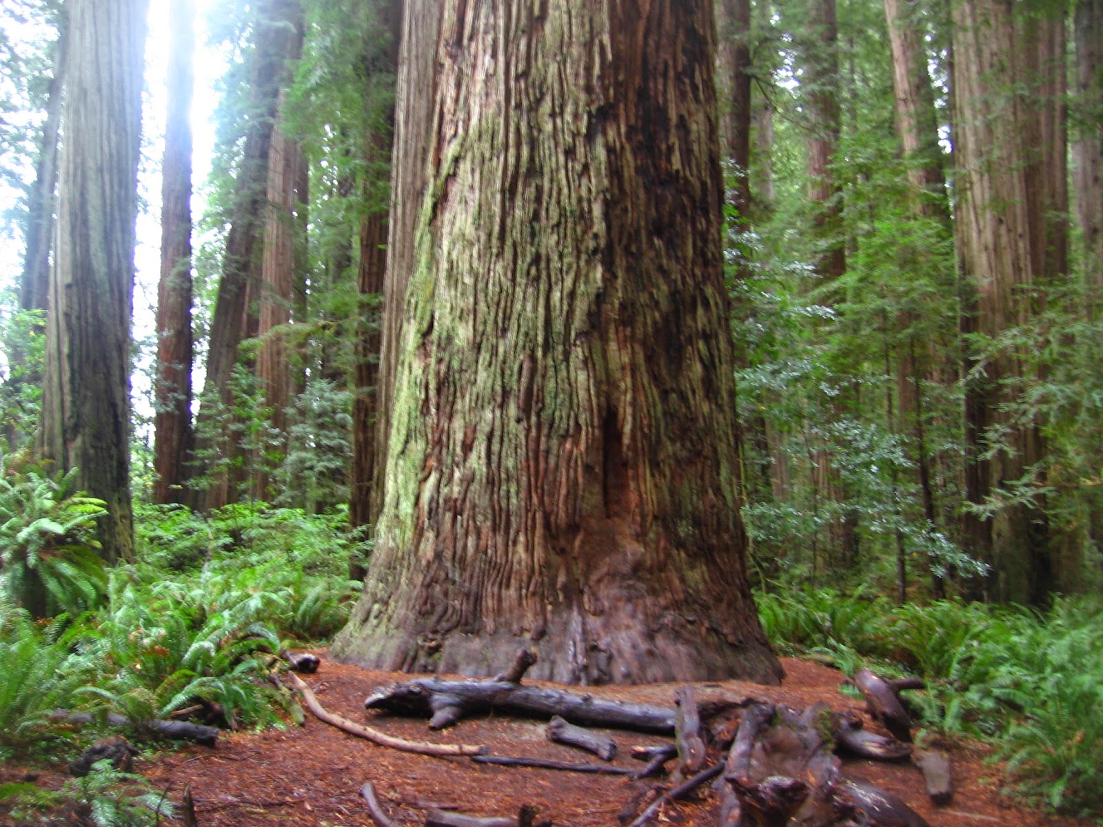
Remember when I expressed that the 4 to 6 foot diameter cedar tree was the biggest I had ever seen?  That record was surpassed many times over in one afternoon today.  We walked around in the Stout Redwood Grove just outside of Crescent City.  These are Coast Redwoods and a lot of them are 15 to 16 feet in diameter.  How do I know that?  I stepped them off, even walked around the circumference and did the arithmetic.  One living, apparently healthy tree measured 21 feet in diameter.  They can be 300 feet tall.  That was what it said in the book, I couldn’t measure that.  The book also said they can be 26 feet in diameter. The bigger ones are so straight and tall and mostly have no limbs except near the top, maybe the last 100 feet.

This grove of Redwoods is set aside for preservation and protection and is part of the California State Park system.  The Coast Redwood is one of three known species of Redwood trees.  We’ll see another later in the trip, the Sequoia Redwoods. 

We didn’t complete the trip we were on Friday because of rain so we went back today, Saturday.


The camera can’t capture the size of these trees.  There is no perspective where you can show an entire tree except right next to it and shooting straight up and then you can barely tell what it is.  In fact, I found that my mind can’t even absorb the scene.  We both were constantly head bobbing up and down and side to side.  This is a place of the gargantuan.  We stood small before these gigantic living things.  The relative scale of tree to man is not only of size but also time.  These large trees may be 2000 years old.   What was the world like when the 21 foot Redwood was a sapling?  It may have been 15 feet in diameter and a couple of hundred feet tall in the time of Columbus.


The 21 foot diameter Tree

Friday, October 17, 2014

Crater Lake National Park

Wednesday morning we left Mount Vernon, Oregon and drove to Crater Lake National Park.  It’s in the southwest part of Oregon.  The landscape changed fast from scrubby plateau at the fossil beds to conifer-forested mountain around Crater Lake.  I don’t know how far the trip was exactly, probably close to 200 miles, but it took most the day.  We also made a couple of stops for gas and groceries. 

We came in the West Entrance to the park about 5:00 hoping to get a camping spot at the park campground but it had closed for the season on October 5.  We should have checked that out before we got there because it was a 23 mile drive upgrade from the highway with the trailer in tow.  But there were other possibilities once we got back down to highway 62.  We pulled into a Forest Service Campground but the sign said “not recommended for RVs over 28 feet”.  So we thought about this for a little while and then a man came out of the campground so I asked him about it.  It turned out he worked for the concessionaire that operates the campground and he was closing it for the season.  He asked how many nights we needed and I said two.  So he said we could stay two nights and he would take us to a site where we could fit in.

It was a squeeze getting back in the campground, especially between two big trees on a curve.  The awning got by with about two inches to spare.  But somehow we got it in and here we are.  We are the only ones in the whole campground.  It is beautiful, gigantic pine trees must be 4 feet in diameter, and the Rogue River runs right behind our site.

We went into the National Park today and spent the whole day on the east and west rim drives.  I have to thank Ian Prime for suggesting this be one of our stops.  (Thanks, Ian.) This place is just incredible and I would say to anybody, Do Not Miss It if you are close by.  In fact, go out of your way to come here, it is worth it.

I’ll explain a little as I can.  Geologists say that about 7700 years ago, Mount Mazama was a 12000 foot volcano sitting atop a pressure container of magma deep in the earth.  (Note that the 7700 is accurate.  That is like a week ago Thursday in geologic time.)  There were also other volcanoes around it, all of them hot.  When Mazama finally erupted and released all the stuff of volcanoes beneath it, there was nothing left below to support the mountain so it collapsed into itself creating the crater.  Water from snow and rain gradually filled the crater over the thousands of years to a maximum depth of nearly 2000 feet.  No streams flow in or out so no minerals or impurities get in.  They say it is about the clearest and purest water on earth.  The hues of blue are amazing too and I hope the pictures show that.  We tend to use words like “amazing” and “incredible” a lot, I know, so please forgive the excess.


Being created by a volcano there are some strange phenomena around and in the lake.  One is another volcano, Wizard Island.  It is the big one in the pictures and you can tell it’s shaped like a volcano.  Another one is the frozen lava shape that sticks above water level and looks like a ship from a distance.  This is Phantom Ship.  Still another strange thing, outside the lake crater in a canyon, are spires of volcanic stuff called Pinnacles.  This truly is weird.  These things are hard volcanic plumbing and stayed hidden under the earth long after the eruption.  Gradually the softer materials of the volcanic ash and pumice were eroded away exposing them.  You can see that they look like they are cooked.


Crater Lake Model in Visitor Center - Note Wizard Island at bottom of lake.


Crater Lake, note shades of blues corresponding to different depths.  Wizard Island on right.


Linda and Belle at Crater Lake, Wizard Island to the left.


Crater Lake


Wizard Island on Crater Lake.  Phantom Ship is left of snow on opposite bank.


Phantom Ship


Phantom Ship at Timeless Anchor


Pumice Castle at Crater Lake


Pinnacles at Crater Lake